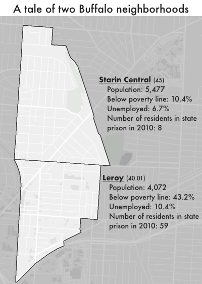
Data Source: For data sourcing see, https://www.prisonpolicy.org/origin/ny/report.html. (Graph: Peter Wagner, 2020)
This graph originally appeared in Mapping disadvantage: The geography of incarceration in New York State.
Events
- September 14, 2024:
Our advocacy department will host a workshop at the MacArthur Justice Center’s Realizing Releases convening. The workshop will provide strategies for investigating state parole systems.
Register for the convening here.
Not near you?
Invite us to your city, college or organization.


